
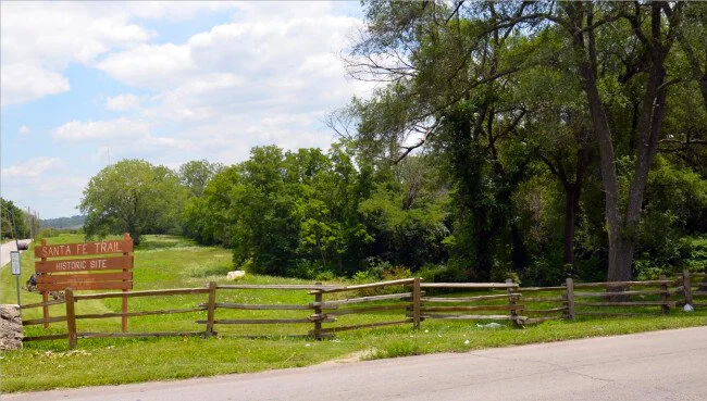
Early Santa Fe Trail Route from Ft. Osage West to Independence, MO


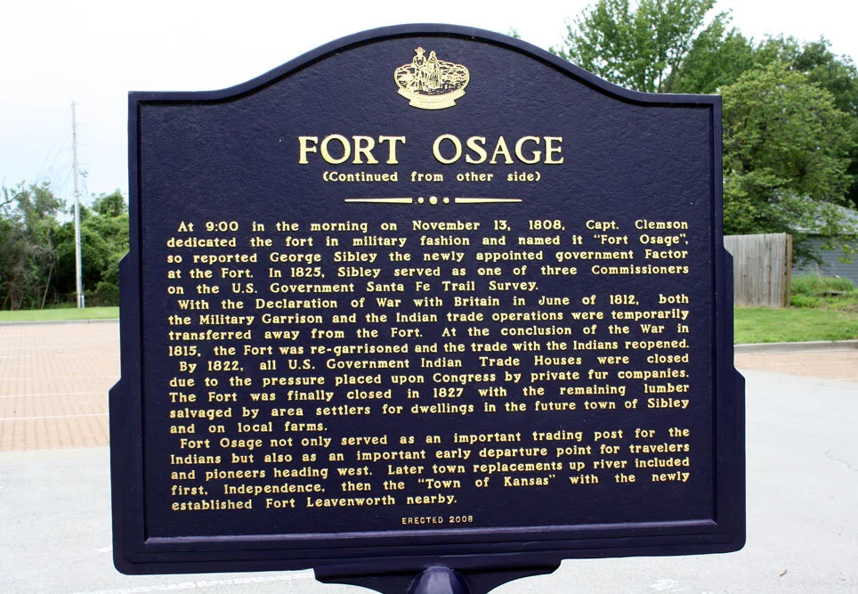


Fort Osage is located by the Missouri River at 107 Osage Street, just northeast of Sibley, MO. Built in 1808 by William Clark to promote Ft. Osage Indian trade and abandoned in 1820s as new settlers took the logs, etc… Fort reconstruction was completed in 1961. Here you will find many fascinating snippets of history.
Front and back side of upright marker (16’ x 24”)text on post “Fort Osage” erected by The Native Sons and Daughters of Greater Kansas City.
Small plaque about restoration of Ft. Osage
Wayside exhibit entitled “A Commanding Position” Large black stone monument “The Trail to Fort Osage” – including a map from St. Louis and founding history
Wayside exhibit down at Mo. River bank entitled: “Missouri river at Fort Osage”
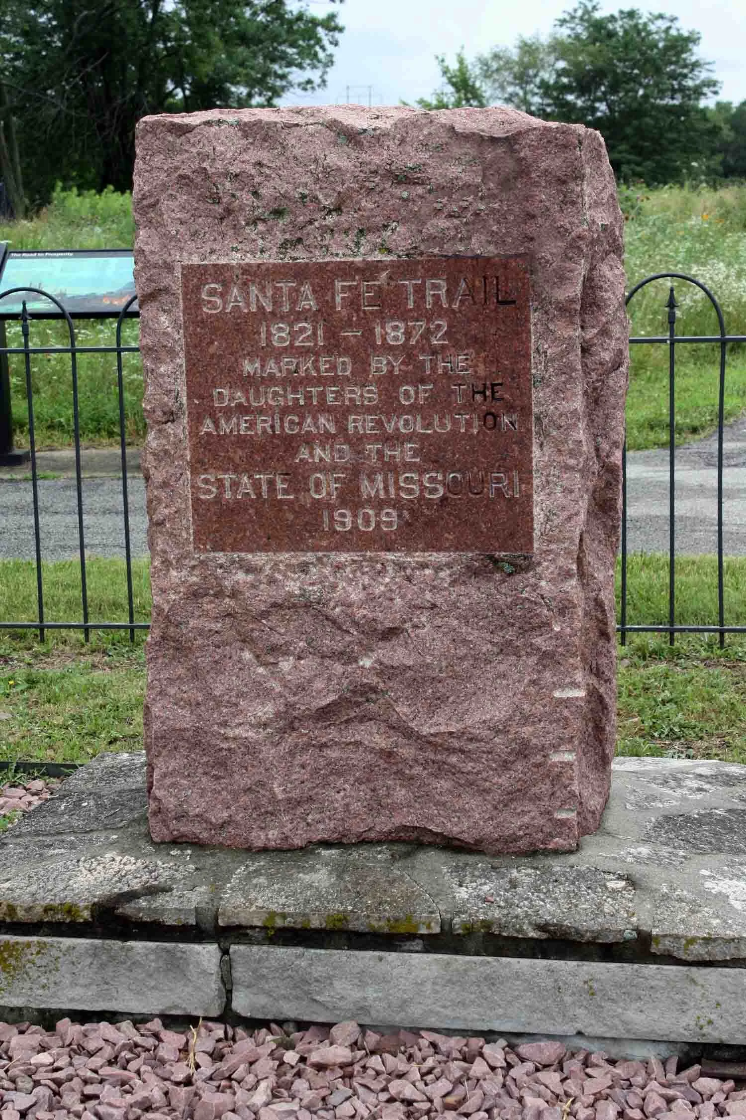
You will also find a stone monument / marker / DAR SFT monument
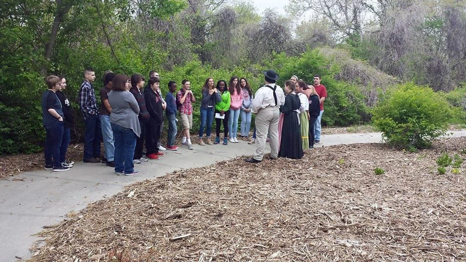
Ft. Osage site including Education Center and Fort
“Step back in time and experience the lives of the men and women who secured the American frontier at Fort Osage National Historic Landmark. Built in 1808, under the direction of William Clark of the Lewis and Clark expedition, Fort Osage served a dual roles as both a military garrison and a trade center. Today, authentically attired historical interpreters take visitors on a journey through Fort Osage’s past. Visitors will enjoy breathtaking views of the reconstructed historic site that overlooks the Missouri River as they learn about the daily life of military, civilian and Native American populations at Fort Osage and explore museum exhibits at the Fort Osage Education Center.“ (Makeyourdayhere.com)
*Another nearby notable site to visit is in Buckner at the north side of town at the entry to the ballpark on Buckner-Tarsney Road: Upright marker, 3 stone monuments, and one SFT marker.


Salem Park is located at 19901 E Old Lexington Rd, Independence, MO 64058 at Highway 24 and Blue Mills Road. You will find 3 NPS upright kiosks / CW wayside / DAR Santa Fe Trail monument.
*See Fort Leavenworth Military Road and Pioneer Crossing Park on the Kansas Trail Markers page where the Santa Fe Trail continued through those areas in Kansas.
Independence Route


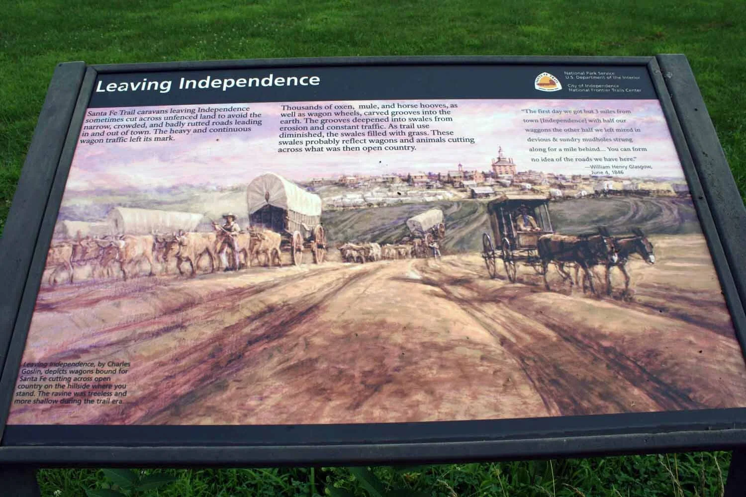
Upper Independence Landing and the interpretive panels are located in Sugar Creek, Missouri - North end of River Boulevard. Proceed north through the gate into Cement City property 100 yards to the Landing that overlooks the great Missouri River. This landing was the beginning of the Independence Route of the Santa Fe-Oregon-California National Historic Trails starting in the 1830’s right after the beginning of Independence and lasting until the early 1850’s. The route went south on today’s River Boulevard until it veered southeast at Independence Avenue toward the Square. See the 3 Trails Corridor website for more details. At Wayne City Landing you will discover 5 waysides / marker / panel on post / 2 benches/ MRO post marker

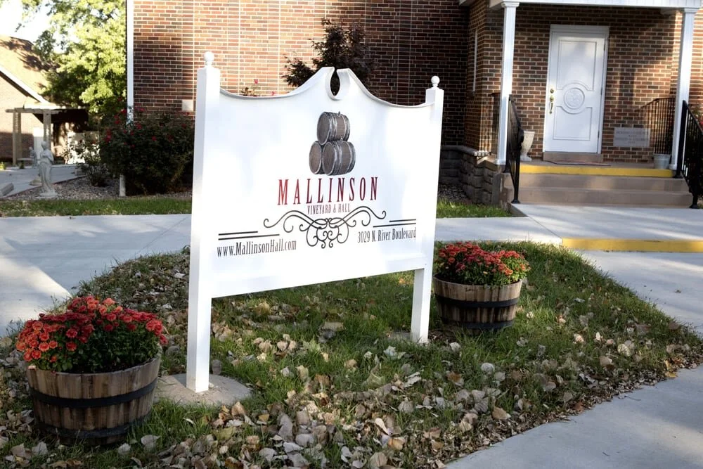
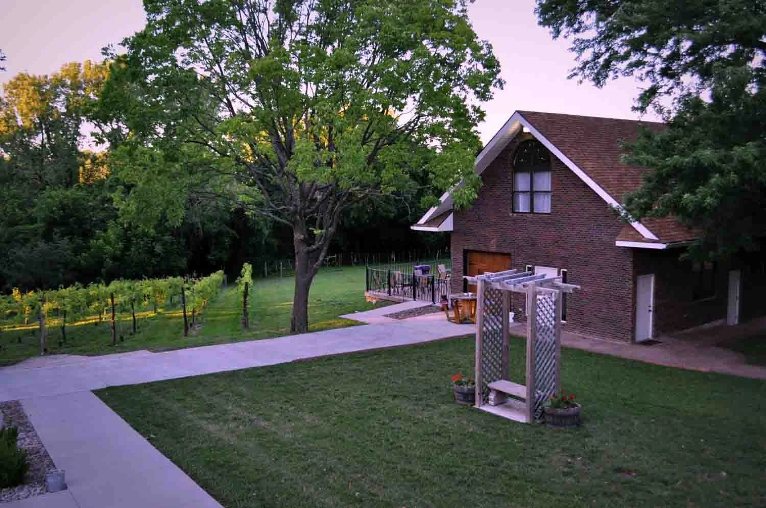
Mallinson Vineyard and Hall is located at 3029 River Boulevard in Sugar Creek, Missouri and sets serenely on the Santa Fe, Oregon California National Historical Trails. The grounds have two Bed and Breakfast homes that overlook the vineyards and also has a hall for events with a lovely winery, large patios and beautiful wedding venue.


McCoy Park is located in Independence, Missouri off of College Street and Bess Truman Parkway.
The Independence Route veered southeast from River Boulevard at Independence Avenue towards the Square, passing about two blocks west of McCoy Park and this shelter. Markers are under a shelter – all dedicated August, 2012 as part of the OCTA Convention held in Lawrence, KS. The beautiful historical McCoy House is near the park. Discover more in the PDF’s below about about Hiram Young, one of the most influential and successful entrepreneurs of the time.

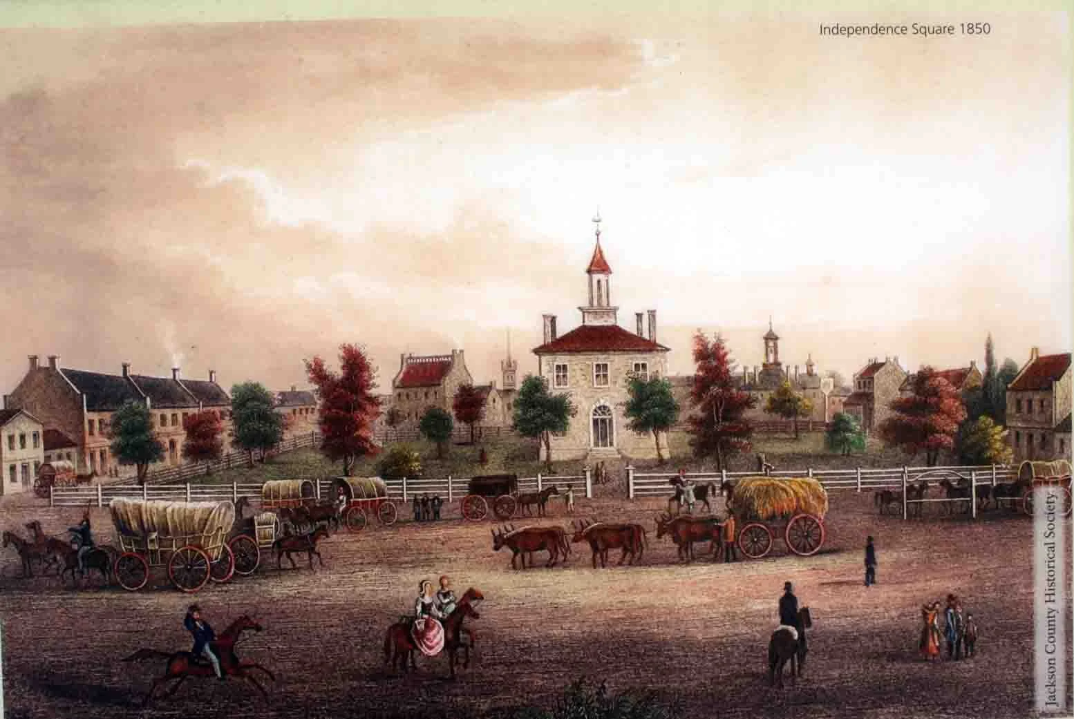

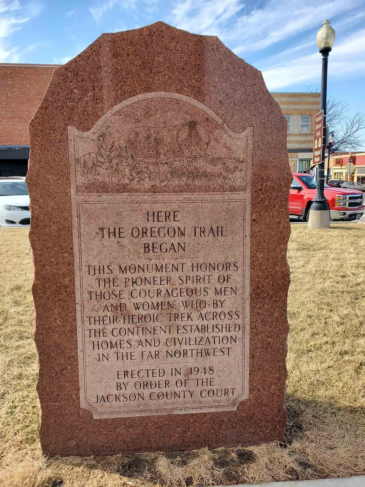

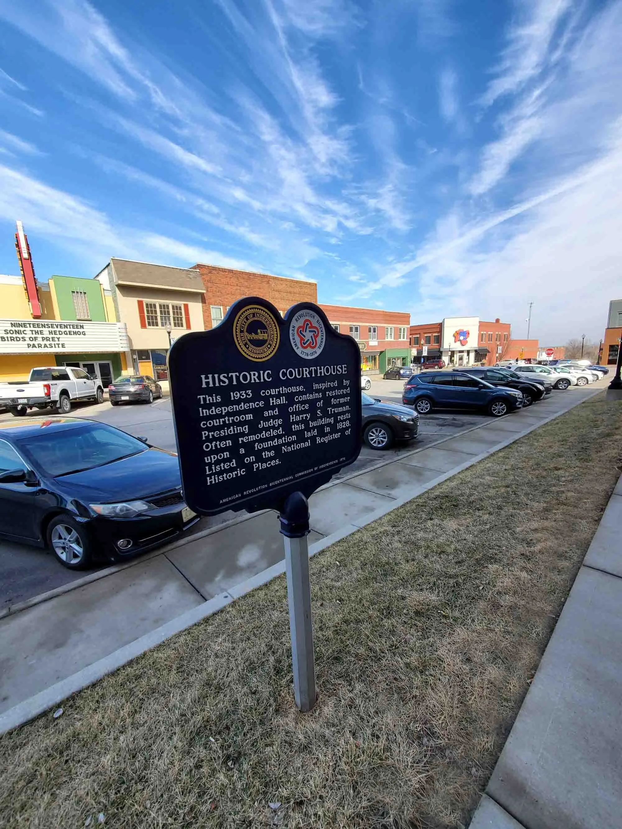

The Independence Square is located in Independence, Missouri on Liberty Street and Lexington Avenue.
This site was set aside for the Courthouse when Independence was founded in 1827. The Independence Route of the Santa Fe, Oregon and California Trails came south from Independence Landing and passed through this site. Trail travelers outfitted at this site, buying their wagons, animals, supplies and other equipment in preparation for their journey.

Bingham Waggoner Manstion and Estate is located in Independence on 313 W. Pacific Avenue. The historic park is south of the house across the creek.
The Independence Route of the Santa Fe – Oregon – California Trail traversed the park land north to south. The Bingham Waggoner Mansion has existed at this location since about 1827, running right along the historic Santa Fe Trail. From this location, wagon trains would set out for the west. A swale in the ground created by numerous wagon wheels, can still be observed today. Learn more about the trail history, mansion and enjoining park on their website.
As you travel through the many historical sites you will find Local Tour Route signs speckle the roads located all along the 3-Trail Corridor from Independence Landing to Gardner, KS. Erected with funding from the National Park Service in 2016-2017 to enable drivers to follow and turn without losing sight of the route.
Santa Fe Trail Park is located at East 23rd St. and Topping Avenue. KC Parks acquired 34.89 acres in 1967. The park boasts a MRO post with 2 plates and logo.
Other notable historical monuments, markers, posts and sites are located at Raytown High School displaying a MRO limestone post with plate and 3 trail logos. Blue Ridge Elementary display a MRO limestone post with a plate and 3 trail logos.
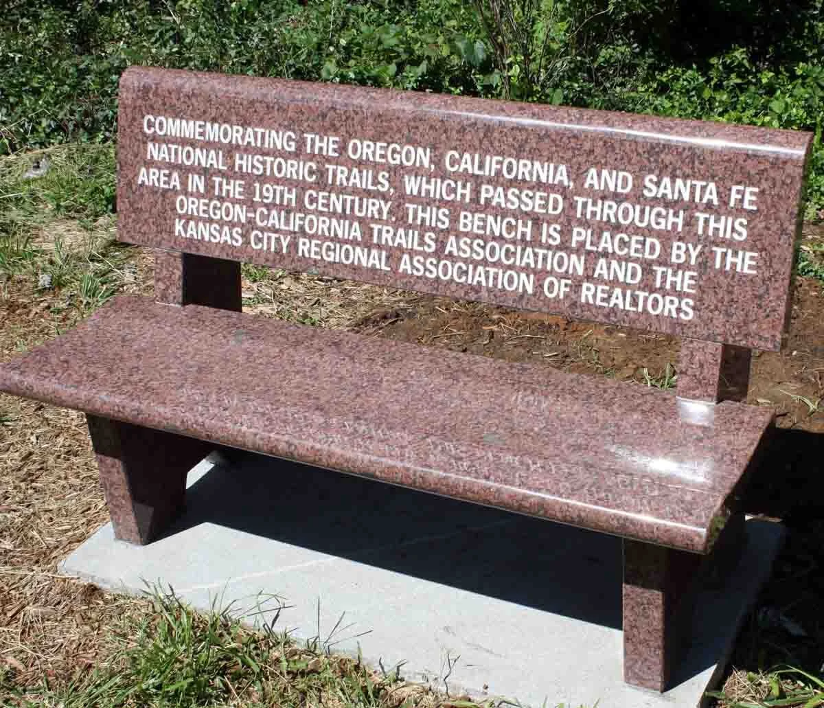

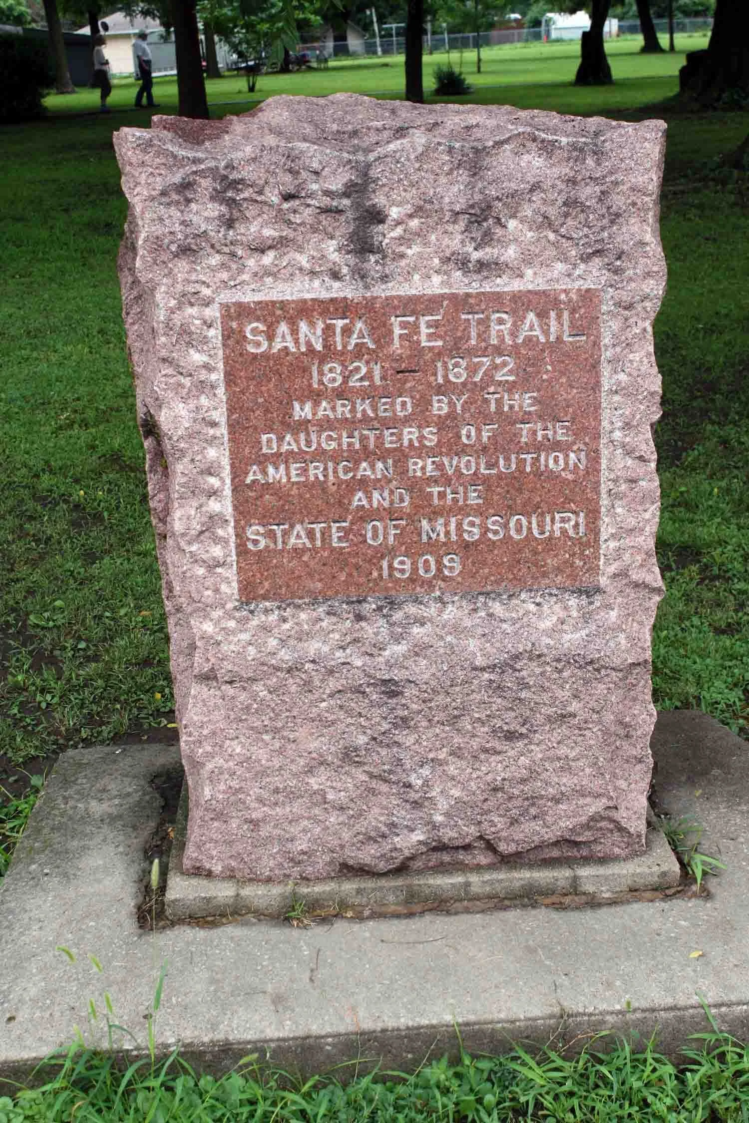
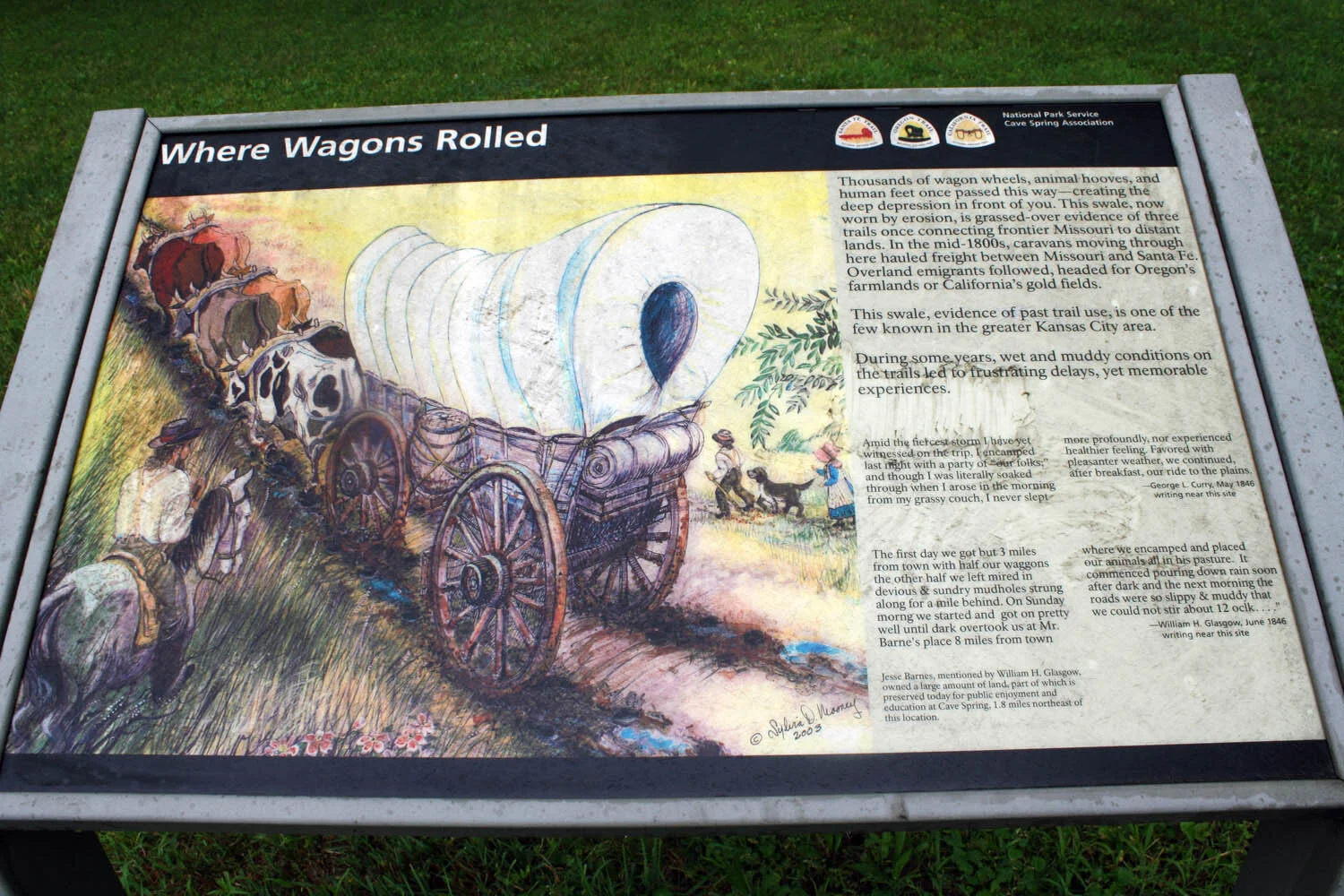
Cave Spring is located at 8701 East Gregory Boulevard on the Independence Route. The bench seat was placed in 2016 by OCTA to commemorate the Santa Fe, Oregon and California National Historic Trails. You will also find: an upright plaque on a post that reads: “Barnes Enclosure” and lastly you will see the DAR SFT monument.


Schumacher Park is Located in Kansas City, MO at 6601 East 93rd Street - Two blocks east of Hillcrest Road, about 200 yards south of Independence. The land was donated in 1993 by Lou and Topper Schumacher to the Kansas City Parks and Recreation.
It was dedicated on August 29, 2000 and upgraded in 2015 with new entrance, parking space, bench and a surrounding fence enclosure for 1909 DAR Santa Fe Trail Monument with new wayside exhibits under the shelter. 1909 DAR marker’s original placement was at 87th and Blue Ridge Blvd, but was left in the ditch after road construction.
It was relocated to the former Benjamin Stables at 6401 87th St. by its owner. The marker has been at Schumacher Park for about 20 years. --New limestone post in front with 2 plates “The Santa Fe, Oregon and California National Historic Trails (NHT’s) with the their logos” plus “Franklin 192 miles” with arrow, “Santa Fe NM 821 Miles” with arrow.


National Frontier Trails Museum is located in Independence, Missouri – South Osage Street and Pacific Avenue (on the Independence Route). You will find a wide variety of history and culture.
The National Frontier Trails Museum opened in early 1990 with a mission to be a history museum, interpretive center and research library to educate the public about the four National Historic Trails that course through Kansas City: Santa Fe, Oregon, California and Lewis and Clark. It was the first of several along the Oregon-California Trail and continues to be a very prominent leader in our area and all along the trails.
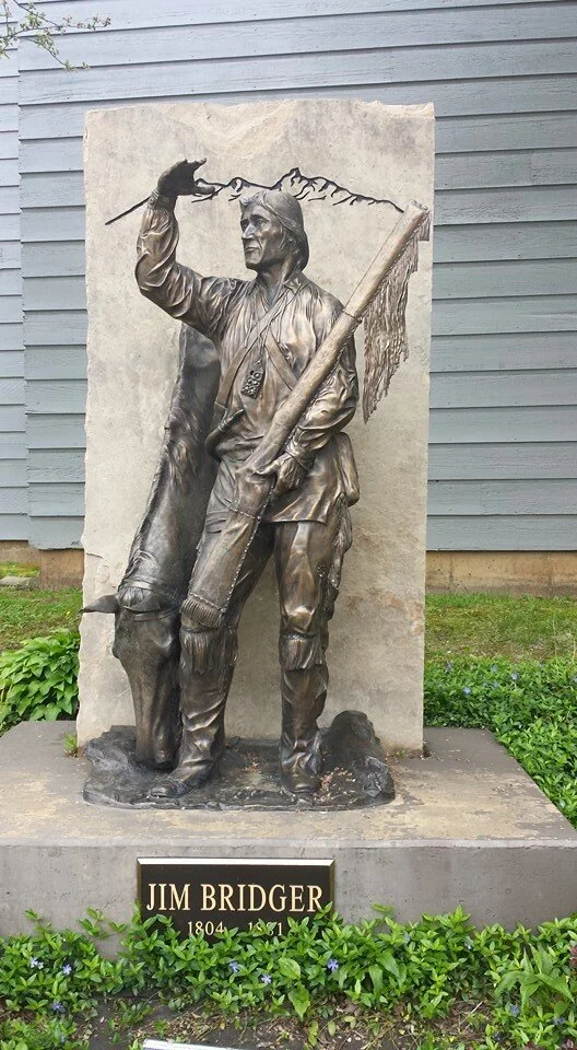
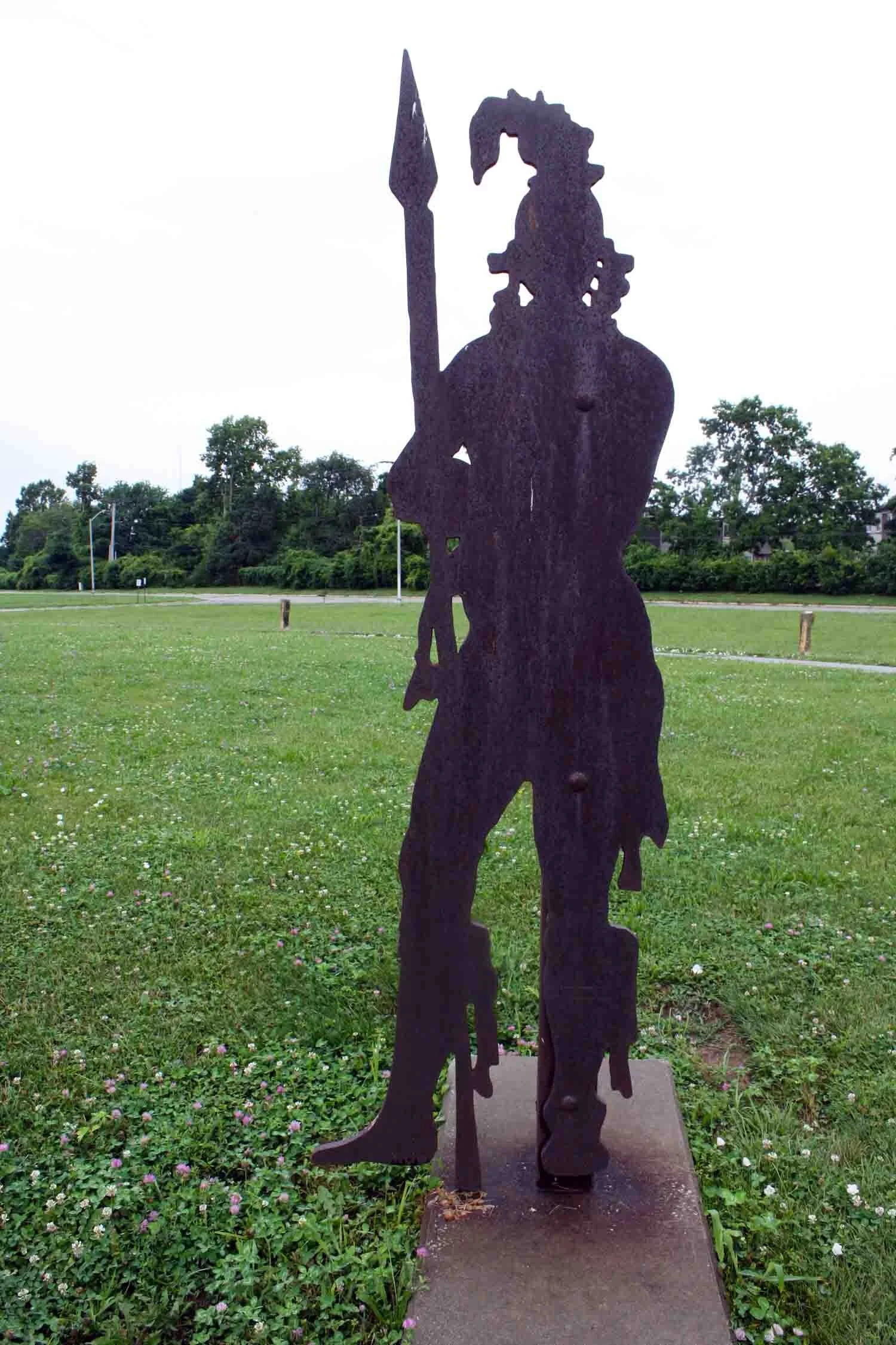
Outside you will find Sculptures of a Pioneer Woman and Jim Bridger.


Pioneer Park in Westport is located at 43rd Street and Broadway, Kansas City, MO. You will find several miscellaneous plaques, plus three sculptures and a large map on the ground showing all of the frontier trails.
Pioneer Park in Westport at Westport Road and Broadway was dedicated on October 10, 1987. The Westport Route was about one block to the west through Westport.
Site view of plaque, U.S. trails map & the three sculptures below
Sculpture of John McCoy, Alexander Majors and Jim Bridger
John C. McCoy plaque (founder of Westport)
Other notable sites in this area include:
Westport Road and Pennsylvania in Westport is 3 plaques of Westport’s history on Kelly’s Bar and Grill and on a building diagonally across the street.
Santa Fe Trail (SFT) upright marker on southeast corner of Mill Street and Westport Road in Westport with the Chouteau Society marker on the post.
Intercontinental Hotel –Wornall Road at Ward Parkway display the Native Sons of Kanas City SFT bronze plaque.
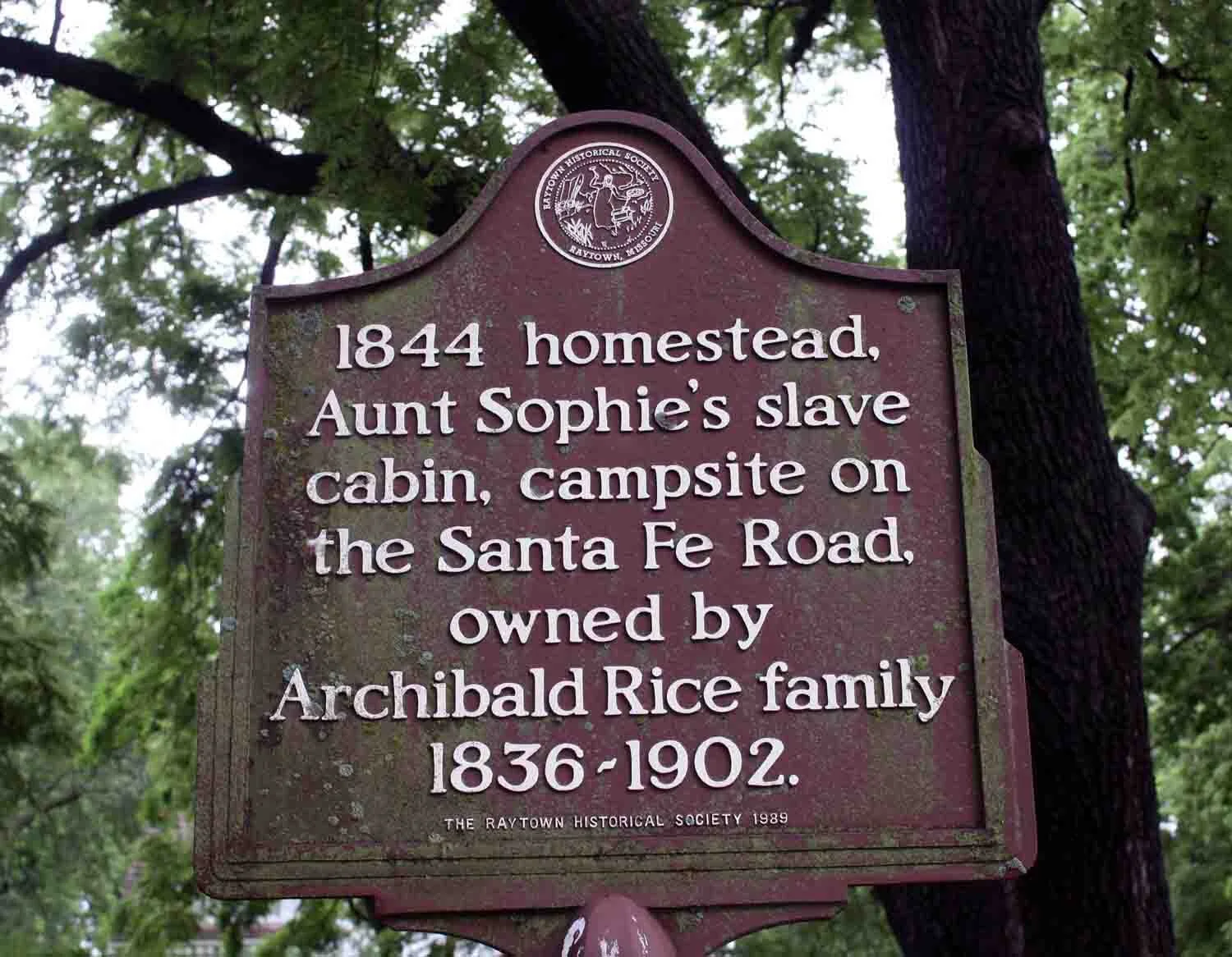
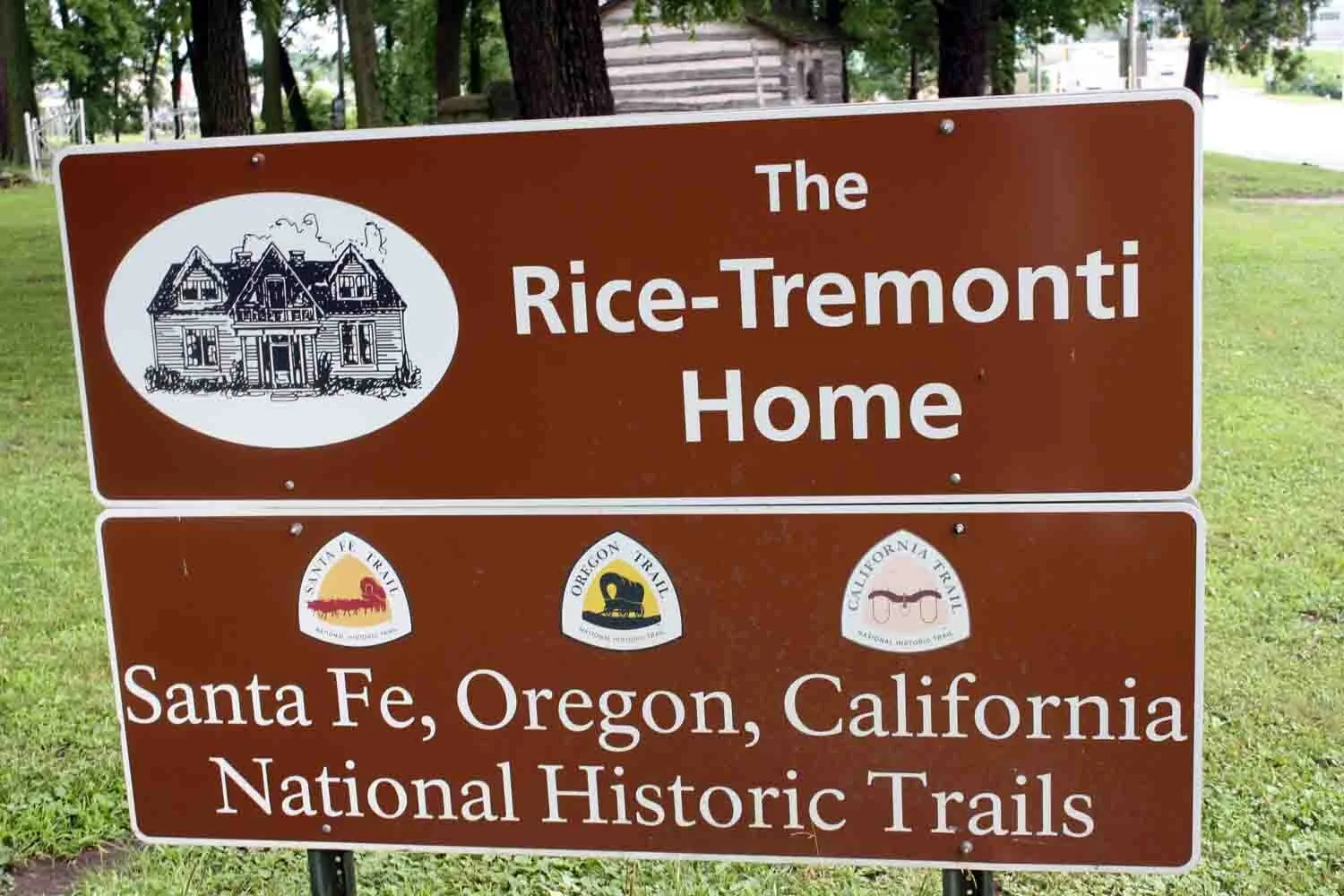
The Rice-Tremonti House is located in Raytown, Missouri on 8801 East 66th Street (on the Independence Route).
The Rice-Tremonti House was listed on the National Register of Historic Places in 1979. Built by Archibald and Sally Rice in 1844. It is believed to be one of the oldest surviving wood frame houses remaining in Jackson County. Many wagon trains camped here and bought animal feed and other supplies from Archibald. He died in 1849 and his son Elihu Coffee Rice became the owner. In 1850 Elihu married Catherine "Kitty" Stoner White, who had a slave named “Aunt Sophie". They built her a log cabin which still exists here. Sophie remained with the family and died in 1896.


Wieduwilt Park is located in Raytown, Missouri at 85th and Manchester on the Independence Route.
The plate on the limestone post “Wieduwilt Swales” was placed by the local Missouri River Outfitters Chapter of the Santa Fe Trail Association.
“Wagon ruts were made by annual throngs of oxen-led wagon caravans that trod the earth and left deep depressions. The greater Kansas City area is unique in having a handful of these 19th century reminders preserved for current and future generations.” See the 3 Trails Corridor Website for more details and directions.
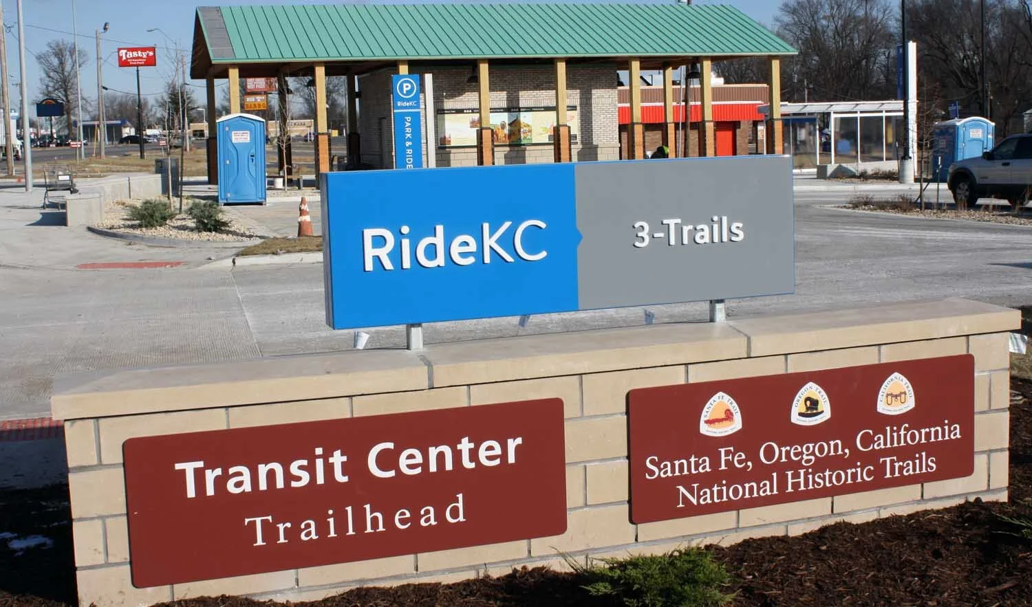


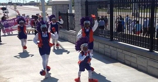
The 3-Trails Transit Center is Located in Kansas City, Missouri, Bannister Mall and Blue Ridge Boulevard – ¼ mile SE of the Independence Route. The Transit Station was dedicated in 2018 and includes six wall panels: three about trails and three about three African-American female slaves who traveled the trail to enjoy good careers in the west.

The Powder Mill Bridge is located in Kansas City, Missouri on Bannister Road (95th Street) over I-435 and is 100 yards north of the Independence Route. It was Dedicated June 9, 2016 and measures 16 ft. wide by 242 ft. long. It is the longest pedestrian bridge on a National Historic Trail over an Interstate Highway in the nation. The trail passes over I-435 just south of the bridge going west-southwest toward Minor Park and Red Bridge.


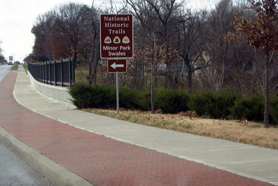


Minor Park is located in Kansas City, Missouri at Red Bridge Road at Blue River. The original Independence Route crossed Blue River about 250 yards north of the Red Bridge of today.
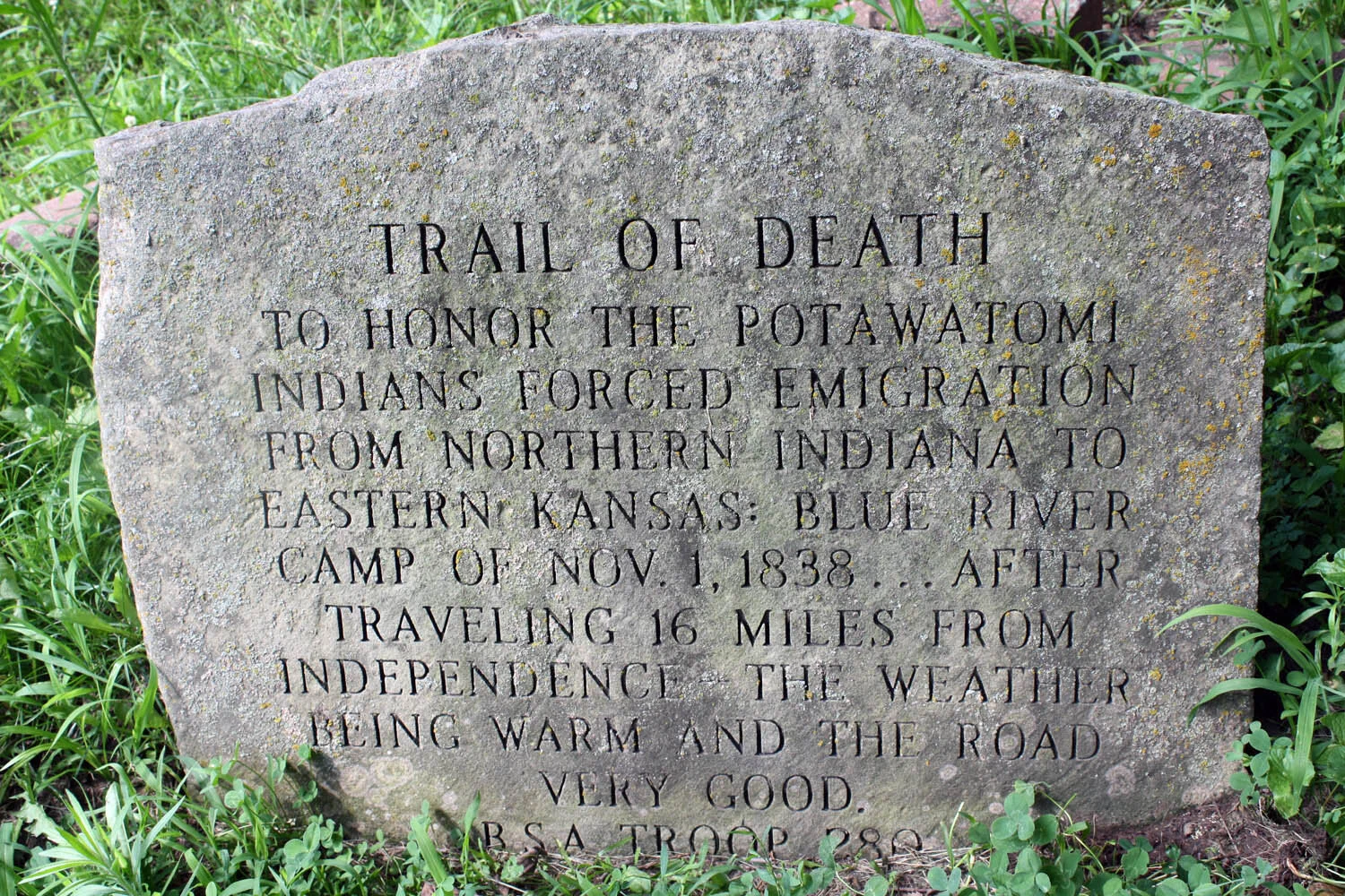
Minor Park east of Blue River displays a large sign that reads: 3-Trails Corridor Red Bridge Segment. The large sign sport the Santa Fe, Oregon and California Trails logos. In addition, you will see the “Trail of Tears” an engraved stone, north of the shelter.
Old Red Bridge - The Red Bridge was erected in 1932 and now loaded with “locked in love” padlocks.
New Bridge includes a Wayside exhibit entitled “People And The Trails” with another wayside exhibit entitled “People And The Trails.” The two waysides are adjacent and display the same pictures and bio as the plates that are on the bridge columns as listed below.
Wayside exhibit entitled “Trails Before Highways”
Wayside exhibit entitled “River Landings and Red Bridges”
16”x30” plate on a column with silhouette photograph image of James Beckwourth, One of ten similar plates of people who may have used this crossing of the Blue River in the mid-1800s. The other nine are Alexander Doniphan, Susan McGoffin, John Calvin McCoy, Don Felip Chavez, Hiram Young, Jim Bridger, Amache Prowers, James Beckwourth, Alexander Majors and Kit Carson.
12”x36” plate of James Beckwourth’s bio, similar to the other nine famous people listed above.
Minor Park west of Blue River exhibits and monument:
Wayside exhibit entitled “Trail Hazards”
Same wayside as above but wider picture of park & swales
The 1909 DAR Santa Fe Trail monument is in a large wagon swale in the park.
Another notable site nearby include:
Big Blue River Crossing is the Original 1821 SFT route. KCAHTA has proposed a new wayside exhibit noting the original SFT crossing of the Blue River, which is just south of the intersection of Oldham Road and Gregory Boulevard within Swope Park. On the high bluffs overlooking the confluence of the Blue River and the Missouri River can be found a large Native American mound structure, designated as Indian Mound Park in the Indian Mound neighborhood of Kansas City, Missouri. The three western trails, the Santa Fe, Oregon, and California trails crossed the river just north of Red Bridge Road and Minor Park. Mountain man/fur trapper Jim Bridger had a trading post at this location.
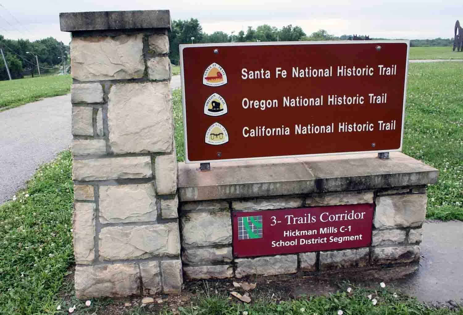


Hickman Mills School is located in Kansas City, Missouri at 9010 Old Santa Fe Road on the Independence Route. All markers and features are along a sidewalk through the site.
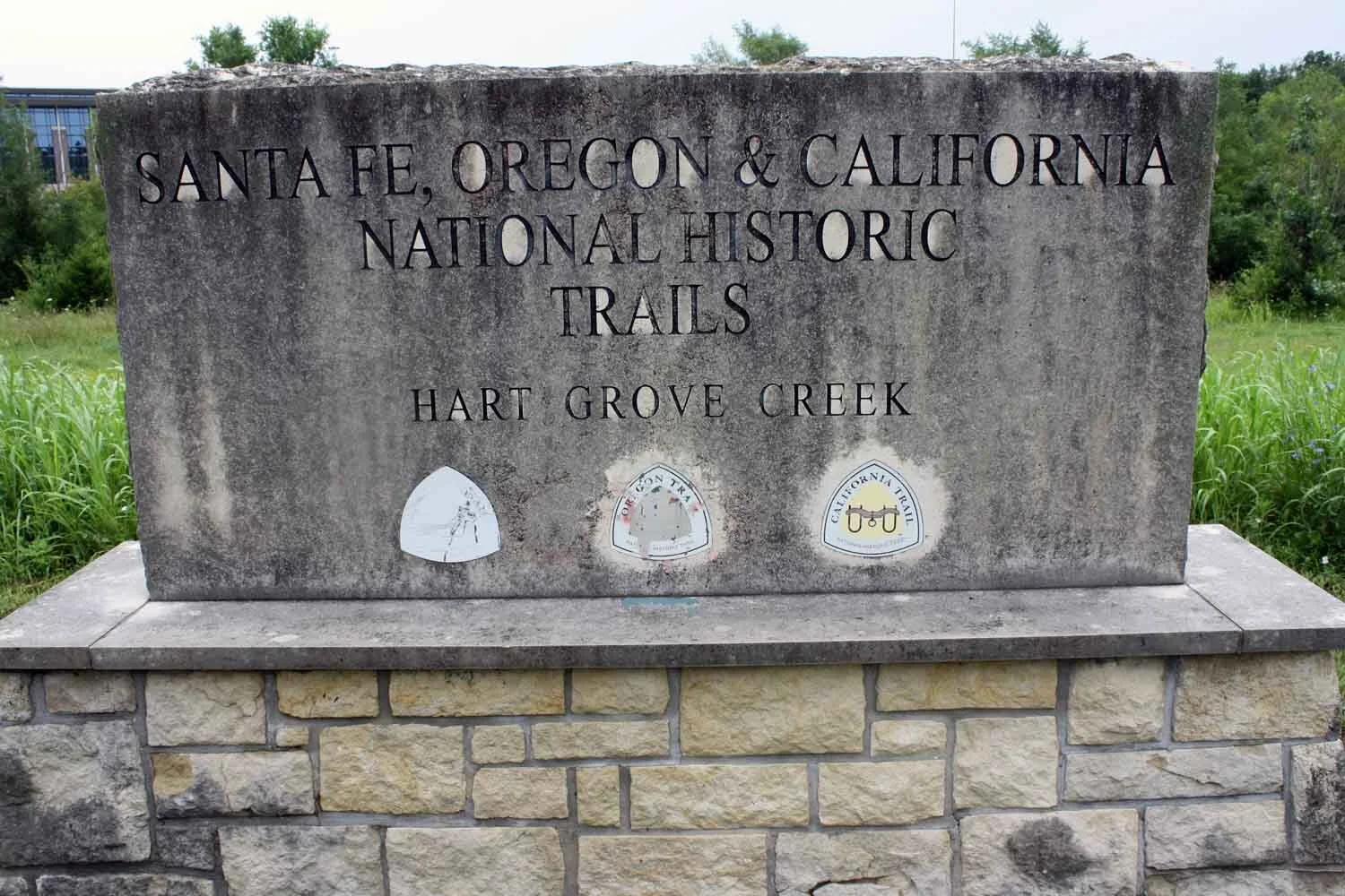


Hart Grove Park is located in Kansas City, Missouri on Marion Park Drive, south of Bannister Mall & west of I-435. The Independence Route went through the area very near the monument.
Other notable sites nearby include:
Gambril Park revealing four swales on the western slope of the ridge.
Watts Mill Park is on the south side of 103rd St., just east of State Line Road. It includes old markers now, but new markers are coming soon. Watts Mill Park is not a trail site, although, James Nesmith in 1843 made an odd mention of it.
St. Thomas More Parish is located at 11822 Holmes Rd, Kansas City, MO 64131. Other notable sites nearby include:
Avila University at 11901 Wornall Rd, Kansas City, MO 64145 includes a new hiking trail around the University and 2 MRO Posts with logos / 7 limestone posts with logos / 2 limestone posts with logos / entry signs on 4 limestone monuments.
The Independence Route went through the athletic field. Other details about the posts and markers include, a large 3-Trails Corridor sign on monument with the three trails logos and “Avila University Segment.” Limestone post with two plates - The Santa Fe Trail “A Highway Between Nations” and the “Oregon and California Trails” with their three logos, several of which were by the Missouri River Outfitters Chapter of the Santa Fe Trail Association. Nearly 20 of these are from the east side of the University to Wornall Road.
Santa Fe Trail St. & Pennsylvania in Kansas City, MO., include a MRO limestone post with plate (moved nearby in front of house at 712 121st. St.)
Avila Street and Santa Fe Trails Street - one block west of Pennsylvania St.., include two limestone posts with a one-piece logo similar to above.
State Line & Santa Fe Trail St. – (At about 122nd St.) includes, DAR SFT on NE corner / MRO post on SE corner with plates and logos.
Jim Bridger marker on post on Carondelet Drive one block east of State Line Road, just south of St. Joseph Hospital at the new Freight Quote office building.


New Santa Fe is located on Santa Fe Trail Street one block east of State Line Road at the cemetery and includes: NPS wayside / upright metal marker on post / faint swale through cemetery.
Historical Society of New Santa Fe describes this area well as mentioned below:
“The town of New Santa Fe stood at the junction of the Santa Fe Trail and State Line Road, now southwest Kansas City. The little village had great historical significance in the development of western commerce in the 19th century.
New Santa Fe was a little post village situated on the west line of Missouri, about midway in Washington Township. The village developed about the farm of John Bartleston, who erected a cabin in the forest along the Santa Fe Trail in 1833 and subsisted on hominy and potatoes. Within a few years, a community known as Little Santa Fe developed. As it was located a day's trip from Independence, wagon caravans laden with merchandise for the Mexican and California trade would stop here before pushing westward.”
National Park Service describe the New Santa Fe Cemetery on their site:
”Teamsters created this route, urging heavy freight wagons to and from New Mexico. In the 1840s-50s, pioneer families traveled this part of the Santa Fe Trail as they started west to Oregon and California…”